Next: September 8th: Sulzenau to Dresdener.
From the Wilder Pfaff and Zuckerhutl I went back to the Nurnberger, had a look at the (Aperer) Feuerstein and then went to the Sulzenau for a rest day. That concluded my first week.
Miriam (who has suddenly appeared in this tale, but I won’t mention her much) and I were off to the Dresdener in the afternoon, so I had all morning to do something interesting, which thing was to experiment with the Lubeckerweg up the Wilder Freiger. “But!” (You’ll complain) “You’ve already climbed the WF“. Well yes I have. But a mountain is a big place. I’ve descended the glacier part of today’s route, from the yukky col by the Mullerhutte, but the cables on that col are now removed. But that was in 2001 and the glacier can be quite different now (the route disappears off into the top left of that pic). As usual, today’s route is available as a GPS track. Note that while this post is written in the confident tone that only hindsight can provide, on the day I was quite uncertain as to whether the route was going to be plausible, either on the glacier or ridge sections.
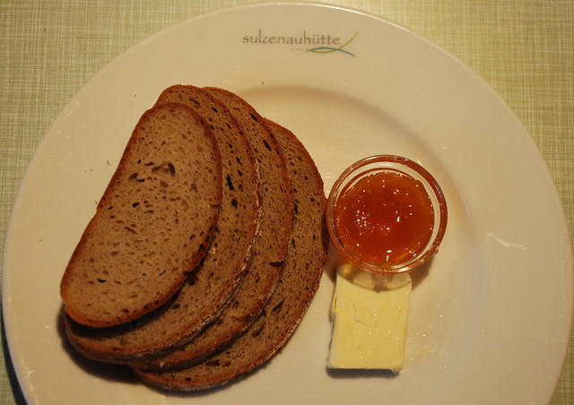
6:30 Kleines fruhstuck. Yes, that really is it, apart from the cup of coffee: dwarf bread, butter and jam. I packed my bag last night so get off early, for me, at 7. I’ve decided it would be an interesting experiment to take a pic every 10 mins on the way – perhaps it might give a better feel that the usual only-take-pix-of-the-interesting-bits, and give some idea of the slog of climbing up. So you’re not allowed to complain that some of them are a bit boring. Though today the weather is so good its a joyous route up, and makes up for any numbers of slogs on other days.
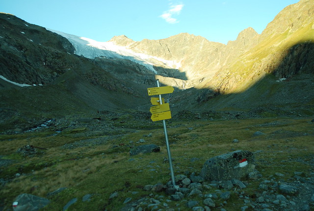
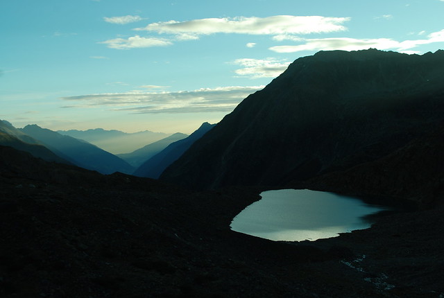
Just leaving the hut. The usual helpful signpost and first path marker. In the distance the sun, so despite my vaunted “early” I’m actually fairly late. But I won’t need the extra time, and 6:30 was the earliest they do breakfast. In the distance – just above the signpost pole – is the glacier whose retreat I blogged a few days ago; and the waterfall falls from its lake.
En route, with the mountains burnt out in the sun ahead. Sorry: but since I was breaking my march to take these, I didn’t stop for long enough to get the exposures exactly right.
Higher. A lovely diagonal of darkness and a perfect blue sky.
Looking back. It really was a mind-bogglingly beautiful day. The next one is pretty good too.
Slightly cheating, because that’s off to the right not straight ahead.

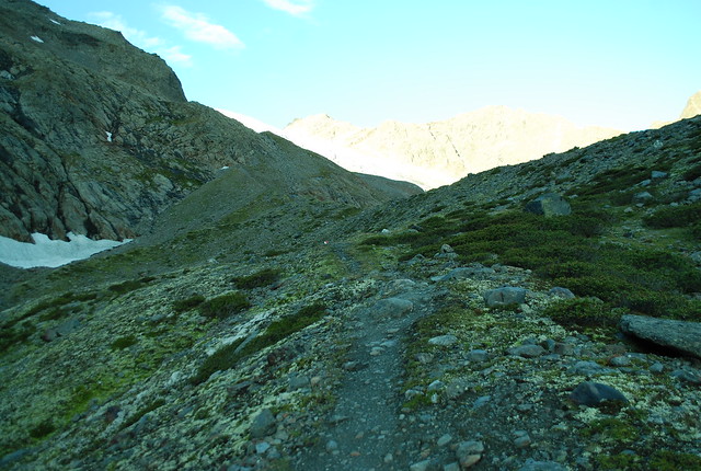
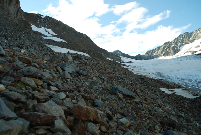
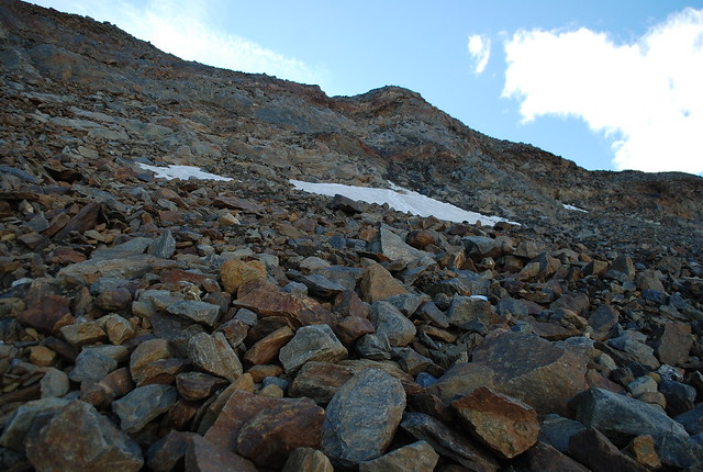
No longer cheating. The path and the path markers wend off into the distance, we’re climbing the rocks and moraines of the East bank of the glacier. A little higher up is a helpful reminder of the way back to the Sulzenauhutte.
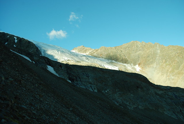
Still heading up the rubble. Snout of the Fernerstube appearing ahead; my old map shows it to be solidly connected to the Sulzenauferner, but it ain’t no more.
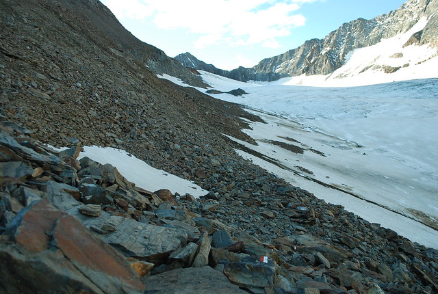
On a level with the glacier now, and oh, is that a signpost I see just ahead?
Doesn’t look too different to the previous one, but I promise you we’re 10 minutes further on. That’s (counts) 1:10 into the day; 500 m up.
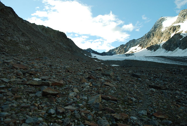
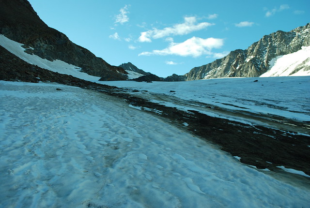
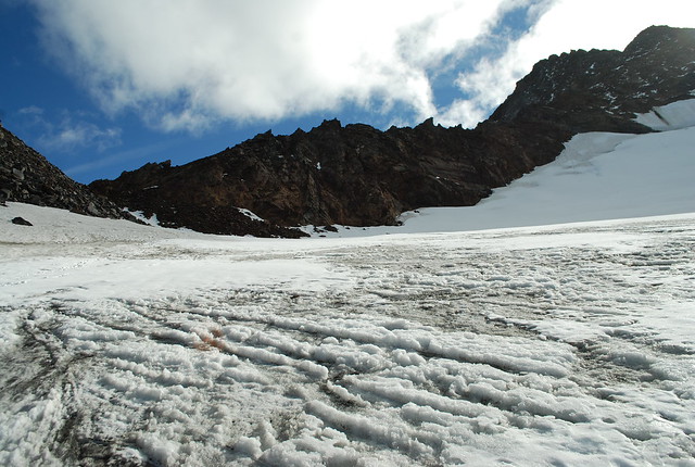
And on. the glacier is getting more snowy, and the path (always reluctant to venture onto glacier) is running out of places to go.
This was quite amusing. Since I’d got off fairly early, and the sun was certainly nowhere near this ice, it was hard. And slippery. And just this insey once I’d decided, in the interests of lightness, not to take my crampons. So I was forced to cut steps across the ice, how antique. At least for the places where it wasn’t covered in rubble.
Now I’m a bit higher, there’s a light dusting of hard snow on top of the ice, so careful edging is all I need and I can stop cutting steps, thank goodness. At this point I’m actually a bit puzzled about where to go. My map – and indeed my eyes – warn me that up ahead the glacier gets a bit steeper and a bit crevassey. Meanwhile high up on the rock to the left are the words “LUBECKER W F” painted in 6 foot letters on the rocks. But getting to those words doesn’t look easy.
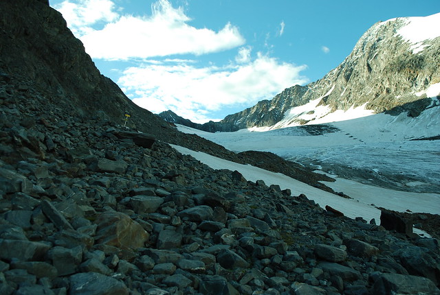
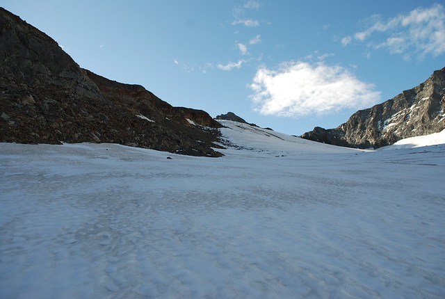
So I prefer to continue up the glacier and the scree, emboldened by the perfect visibility of the day. The total absence of any kind of path or markers concerns me only faintly.
I’m getting somewhere. I’m above the steepening of the glacier, and the peak ahead is the Wilder Freiger, and running down from it to the left is the “climbing” section of the Lubeckerweg. I may or may not be on the sanctioned path at this point, but on a day like today that really doesn’t matter.
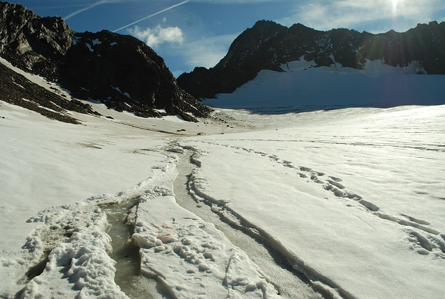
A riverulet in the snow, though frozen at this time of day. And it looks like I may not have been the first ever to come this way, though I am the first today.
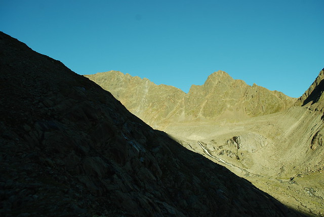
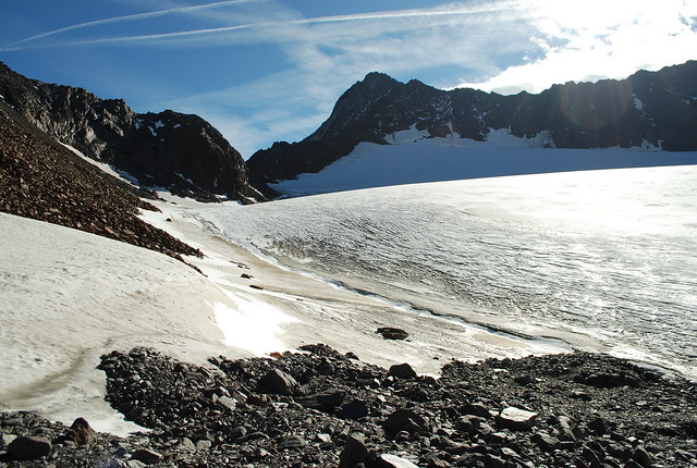
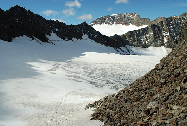
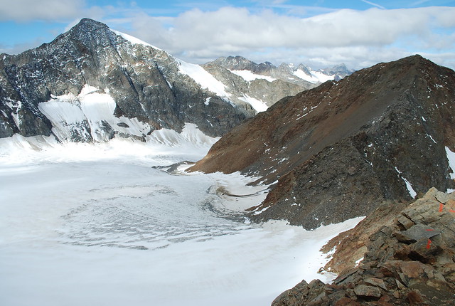
Not along the route: looking South from where I am, across the glacier basin. The high point in the middle is pt 3228 behind which shelters the Mullerhutte. To its right (not left) is the Pfaffenneider 3149 which is the deprecated route down from the Mullerhutte; don’t go there, unless you really know what you’re doing.
Getting closer to the start of the (NW) ridge, which now fills the skyline. Still a gorgeous day, though its clouding up a bit. I got decent views of the Wilder Pfaff from here; I’ve added them to that post.
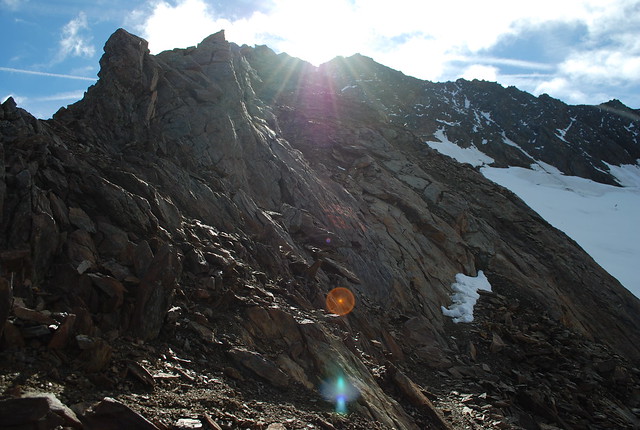
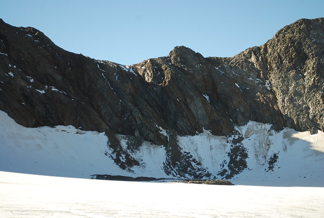
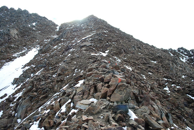
2:40: I’m on the ridge, woo, and all my photographic skills have deserted me. But in fact this is somewhat what it was like: squinting up into the sun to try to trace the line of broken ridge. Although there were some hints as to the correct route. Assuming this is the col, I’m at 3144. This is the start of the “climbing” section, and the Guardienne did tell me this was a climbing route, but scrambling is a better word. Of course, your mileage may vary.
Looking back you can see my tracks, and other people’s. This is looking ESE over the Pfaffenneider in the middle to the Sonklarspitze 3467 which I have not yet climbed but its on my list. The ridge to the Wilder Pfaff rises off at the R edge. It is so nice to be able to see things when climbing.
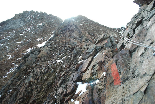
Every now and again there are cables. Always they are escapable. In fine weather, like today, and in ascent, I usually put the tiny effort in required to not use them. But in poor weather in descent they’re often a great time saver and reassurance.
Looking back. Wilder Pfaff again to the L. To the R the Aperer Freiger living up to its name.
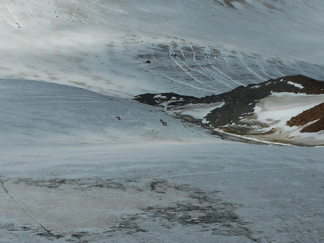
Center of a zoomed version of the above. There’s a party of 4 who I watched, god-like, from above as they moved like ants over the glacier far below me. Oh, the joys of being early and fit.
Are all these pix of the ridge starting to look the same to you? I can assure you I was still enjoying it.
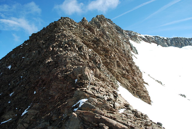
Now we’ve joined the SW ridge and can see the head of the Ubeltalferner to the R (I got this wrong in the first version of this post; this video at 8:50 corrected me). The ridge running out of shot to the R connects the W F to the Signalgipfel. Up ahead is a wooden signpost which I think is there mainly for those descending from the W F to the Sulzenauhutte, so they don’t miss the ridge branching off.

Photographic skills once again showing the strain. On the skyline some handrails / cables on the SW ridge. From here I can look back down the ridge.
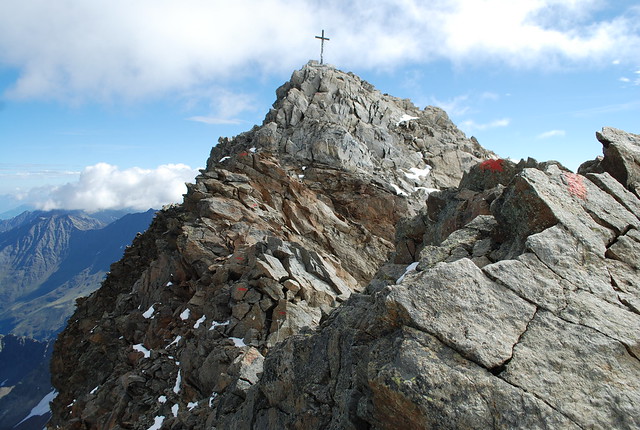
Approaching the summit.
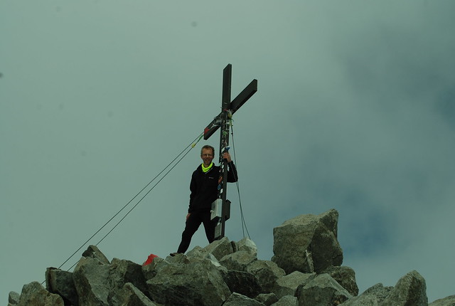
3:35, so its now 11 am. And I’m there: 1200 m of ascent; 6.5 km horizontally. But where’s my sunshine? That’s about an hour for the “climbing” section. It was a bit snowier when I was last here only 5 days ago. I’ve signed the summit book but seemed to have copied the idiot before me and written it as the 9th. Somehow, I must have forgotten to sign on the 3rd? Or done it on the previous page? I’m not sure.

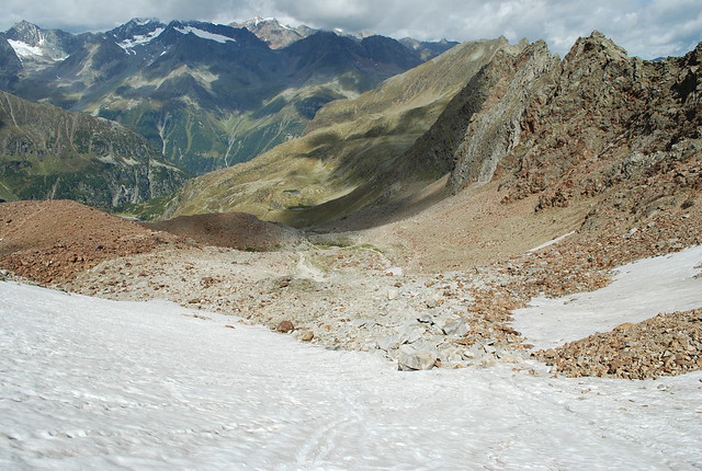
That’s rather a lot of pix for one post, so I’m going to spare you all of the descent, lovely as it was: a circuit via the Seescharte and Grunausee. I will show you this: its taken from around about 2800 m looking SW back up to the WF summit (skyline, somewhat R of center). I mention it because I managed to stuff up, yet again, the correct line of descent. You (alright, I) need to stick fairly closely to the NE ridge line, until you descend the snow into this bowl and then follow the path. That’s easily done going this direction, in ascent: you just exit the bowl following the snow patches. Coming the other way, though, its tempting to let the broad snow on the far side lure you down too far. In which case you get to clamber over the rock shoulder connecting the two, which gets harder the longer you leave it. The broad glacier off to the left, bisected by cloud, is the Grublferner.
To close: view NW down the Klein Grunauferner (which may not be a glacier any more, just neve perhaps) from the Seesharte (view back up). Further down is the lovely blue Grunausee. And so back to the hut, 6:30 total: its now 2 pm.
Or, you could take the video tour. Though these people start from the Dresdener, go over the Beiljoch-of-the-weird-cairns, descend to the glacier and are then on my route; then descend down to the Sulzenaualm.
Diary


Thanx for the pix and travelogue.
LikeLike
I enjoyed this post and album 2014-09-stubai. However I found 512 photos in a single album overwhelming and confusing.
[*You’re* confused? What about me..? And that’s only half of them; there are more to upload. More seriously: posts like this are a partial attempt to organise the pix for me. I make feeble attempts at “best-of” albums too, but its hard work -W]
LikeLike
Your GPS track link is a bit broken for me.
Enjoying the pics. Have driven to Switzerland for camping/walking hols a couple of times, and am looking for other potential destinations. Austria is not so much further…
Might have to get fitter though.
[Thanks; I’ve fixed the link (it was an extraneous CR). Climbing the mountains is optional; I’d guess that 90+% of people at the huts are hut-to-hutting, e.g. http://www.stubaier-hoehenweg.at/en/som/hoehenweg.12.htm/ -W]
LikeLike